Thursday, September 25, 2008

Watch Out Richard Gere! There's Erosion in Rodanthe!

Highway 12, the primary roadway on North Carolina's Outer Banks, has experienced significant overwash over the years. Today we have additional photos of overwash on Hwy 12.
(HT: Ahab's Journal)

A shot of Rodanthe:


A shot of the S-Curves

This section of the Outer Banks, which is adjacent to the Pea Island National Wildlife Refuge, is highly susceptible to erosion. In this location, the highway acts as static infrastructure in an otherwise migrating barrier island. Here are some other pictures depicting island overwash and migration from the Outer Banks Task Force:


Saturday, September 20, 2008

It has been a while since I have posted. Three new class preps have occupied almost all my time. Any additional time has gone to research. I am determined, however, to spend some additional time on my blog in the coming weeks.

It is interesting how little I have heard about Haiti in the news lately. I generally understand, considering the current economic crisis and the 2008 presidential elections to name a few. It has been well documented how busy news periods detract from international disaster relief. This may be one of the contributing factors in the shortfall of relief to Haiti. From Relief Web:

The United Nations today appealed to donors to make up an enormous shortfall in emergency funding for relief work in Haiti, where hundreds of thousands of people are still suffering from the devastation caused by four hurricanes over the past month.

Only 2 per cent of the $108 million flash appeal has so far been donated, nine days after it was launched, the UN Office for the Coordination of Humanitarian Affairs (OCHA) reported.

OCHA stressed that the situation remains very serious in the impoverished Caribbean country, where over 320 people were killed by the storms and flooding, and 160,000 others are still living in the open, exposed to disease and malnutrition.

Some $54 million are needed for emergency food aid. The UN World Food Programme (WFP) has already helped feed some 298,000 people since the start of the crisis.

OCHA is also concerned over access to those who have not yet received aid, including people in the Artibonne and Nippes regions, where continued rains might complicate relief efforts.


From BBC

Tuesday, September 2, 2008

Gustov's Impact on Gulf Oil and Gas Operations

The Timoney group has a mashup map depicting Oil and Gas operations impacted by Hurricane Gustov. The site uses Microsoft' Virtual Earth to depict this spatially. Below is a jpeg of the site, provided by the AnyGeo Blog

Monday, August 25, 2008

Changing Behavior: Mitigation in New Orleans post Katrina

From the Times Picayune:

Three years after Hurricane Katrina, houses are still going up across the metropolitan area. And "up" doesn't mean new: It means, well, up.

The sight of homes being raised 3 or 4 or even 10 or 12 feet above ground has become common. But what will this do to the local architectural landscape? What is the impact on neighborhoods? Individual blocks? And how high is too high?
This article discusses a project by the Center for Hazards Assessment, Response and Technology (CHART) at the University of New Orleans.

Early on, Laska says, the group realized that elevation conversation can be complex. The earliest house-raisings post-Katrina often looked like structures on steroids. Laska refers to them as "flood rage houses" -- residences hoisted by people who said, succinctly, "Never again."

In fact, many homeowners lifted their foundations to the level of their Katrina watermarks. Which is actually not such a bad idea, Laska said.

"That kind of reaction is based on actual flood experience. It's a good barometer of what the highest potential flood level might be."

More recent elevations, however, tend to be less severe. "The elevated house has grown on us, and people are doing a better job at it, " Laska said.

It appears that individuals' psychological response to risks has followed patterns discussed previously in academic literature on risk and mitigation. Individuals appear to assign higher probabilities to these risks immediately after the event, thus overcompensating. These people may have raised their homes more because of this experience. As the event becomes more distant in individuals memories, they do not overcompensate as much. This poses the question, will we continue to see less and less mitigating behavior as Katrina becomes a more distant memory?


Here is a link to an interactive map of New Orleans.


Friday, August 15, 2008

Intro Topic: Dead Zones

I am starting a new series of blog posts for students in my intro to coastal management class. These posts will selectively cut parts of news articles to cover critical coastal management issues.

Photo of the dead zone off Louisiana via Time:

A new study has been published in Science concerning dead zones. From the New York Times:

A study to be published Friday in the journal Science says the number of these marine “dead zones” around the world has doubled about every 10 years since the 1960s. About 400 coastal areas now have periodically or perpetually oxygen-starved bottom waters, many of them growing in size and intensity. Combined, the zones are larger than Oregon.

What are dead zones?
Dead zones are hypoxic (low oxygen) or anoxic (no oxygen) marine or estuarine areas. The absence of oxygen threatens the existence of marine life.

How do dead zones develop? From Oceanus:
The most widespread, chronic environmental problem in the coastal ocean is caused by an excess of chemical nutrients. Over the past century, a wide range of human activities—the intensification of agriculture, waste disposal, coastal development, and fossil fuel use—has substantially increased the discharge of nitrogen, phosphorus, and other nutrients into the environment. These nutrients are moved around by streams, rivers, groundwater, sewage outfalls, and the atmosphere and eventually end up in the ocean.

Once they reach the ocean, nutrients stimulate the growth of tiny marine plants called phytoplankton or algae. When the concentration of nutrients is too high, this growth becomes excessive, leading to a condition called eutrophication.
How do dead zones impact marine life? From the NY Times:

“The overwhelming response of the organisms in our coastal areas is to migrate or to die,” Dr. Diaz said. “To adapt to low oxygen water, it has to be a part of your evolutionary history. It’s not something you can develop in a 40- or 50-year time period.”

Many dead zones are cyclical, recurring each year in the summer months. But over time, they can permanently kill off entire species within the zone. They have also prevented the rebounding of species that are under protection after overfishing, like the Baltic Sea’s cod.

Low oxygen levels also kill off annelid worms and other sources of food for fish and crustaceans.

What are some strategies to address dead zones?

From the NY Times
Robert W. Howarth, a professor of ecology and environmental biology at Cornell, said methods to reduce nitrogen-rich runoff existed, including the planting of winter rye or winter wheat rather than leaving fields fallow after fall harvest. Such planting would cause much fertilizer to be absorbed by the winter crops rather than being leached into waterways by spring rains.
From Oceanus
There are some novel ideas as well. A project is currently underway at Woods Hole Oceanographic Institution to examine the feasibility of using shellfish aquaculture to reduce nutrients in the coastal ocean. The experimental shore-based aquaculture system at the National Center for Mariculture in Eilat, Israel, uses shellfish to absorb excess nutrients excreted by fish. Researchers at WHOI are trying to determine whether the same idea is feasible in the ocean. As the shellfish produced by such an enterprise have economic value, this is an example of a win-win situation.


Examples of Dead Zone Websites
Gulf of Mexico Dead Zone
FAO: Effects of Riverine Inputs on Coastal Ecosystems and Fisheries Resources
NOS: Integrated Assessment of Hypoxia in the Gulf of Mexico
USGS: Gulf of Mexico Hypoxic Zone
USGS: Restoring Life to the Dead Zone

Thursday, August 14, 2008

Revisiting a Theme: It Ain't Easy Being a Commercial Fisherman

The NC Division of Marine Fisheries has released their "Trends in North Carolina Seafood Prices." The Outer Banks Sentinel has summarized some of the findings:

For some species, like shrimp, croaker, and bluefish, the average price per pound in 2007 was lower than the price paid more than a decade earlier.

In 2007, shrimp averaged $1.88 per pound, compared to $2.61 in 1994.

Fishermen were paid $0.30 for bluefish in 2007, less than the $0.36 paid in 1995.

Croakers earned fishermen $0.37 per pound in 2007, but brought in $0.51 in 1990.

A direct correlation between growth of the global seafood market and downward spiraling prices for some, if not all, types of wild-caught seafood produced in NC is hard to deny.

The evidence that globalization has hurt NC fishermen is perhaps most compelling in the case of shrimp, one of the most important commercial fisheries in the state.

Unfortunately, as we see in many situations, opening up trade has led to winners and losers. This article does not directly mention the winners, the consumers of seafood. The consumers now have access to a less expensive product. Elsewhere in the global market, someone has a competitive advantage for many of these products.

There is no doubt that commercial fishermen are the losers in these situations, since they experience lower prices and rising costs.

Wednesday, August 13, 2008

Getting Back

After getting through a family tragedy, I am finally getting the blog rolling again. Here is a fitting photo representing my last couple weeks. (HT gcaptain)

Tuesday, July 29, 2008

Could Offshore Oil Fund Beach Projects?

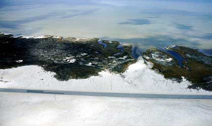
According to the N&O, Walter Jones would like to use proceeds from offshore drilling to fund beach renourishment and dredging projects. Since federal funds for these types of projects have dwindled over the years, I bet that is appealing for some communities such as Nags Head.

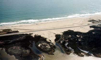
Can these projects bring enough revenue to coastal communities such that the benefits outweigh the potential environmental costs?

According to the Florida Chapter of the Sierra Club:

If that should happen, we should know that:

  • Offshore drilling activities lead to the destruction of coastal wetlands. In Louisiana, where oil and gas development has been conducted for 50 years, close to 62 square miles of wetlands are lost each year.
  • The pollution from offshore rigs causes a wide range of health and reproductive problems for fish and other marine life.
  • Oil and gas operations dump more than 1 billion pounds of mercury-contaminated drilling fluids into the Gulf each year. Mercury levels in the sand around some Gulf rigs are three times higher than levels found at EPA Superfund sites where fishing is prohibited. Mercury levels in marine creatures living around these rigs are at least 25 times higher than in fish found elsewhere in the Gulf. Why then is the oil industry promoting rigs as "fish-rich oasis in the vast desert of the Gulf"? Tests of 70 coastal residents who ate Gulf-caught fish at least once a week show mercury levels of 5-10 times the EPA’s safe level for mercury in the human body. Since Gulf-caught fish are shipped all over the country, this is a health hazard of national proportions.
  • "Routine" offshore drilling operations dump thousands of pounds of drilling muds into the ocean that contain toxic heavy metals such as lead, chromium and mercury.
  • A single production platform, which can drill 50-100 wells, discharges over 90,000 metric tons of drilling fluid and metal cuttings into the ocean.
  • A single exploratory well dumps approximately 25,000 pounds of toxic metals into the ocean.
  • A single offshore rig emits the same air pollution as 7,000 cars driving 50 miles per day.
  • The continued use of fossil fuels poses a particular threat to the residents of Florida. Fossil fuels increase global warming which leads in turn to the melting of the polar icecaps. In Florida, this will result in serious sea-level rise, while the higher temperatures will lead to more tropical diseases and heat-related deaths.

Spill statistics can be found here. Below is a graph of spills in the Gulf, between 1996 and 2007, which were greater than 50 bbls. Notice the higher number of spills associated with significant hurricanes. In 2005, the year Katrina and Rita ravaged the Gulf, 49 spills, each greater than 50 bbl, contributed roughly 15154.3 bbl.


Is this a substantial amount of oil? Deroy Murdock,columnist with Scripps Howard News Service, says no in an op-ed piece in the Seattle Post Intelligencer:

Feinstein is correct. U.S. offshore oil drilling is not perfectly tidy. It's only 99.999 percent clean. Indeed, since 1980 -- as MMS figures indicate -- 101,997 barrels spilled from among the 11.855 billion barrels of American oil extracted offshore. This is a 0.001 percent pollution rate. While offshore drilling is not 100 percent spotless, this record should satisfy all but the terminally fastidious.

Ironically, in terms of oil contamination, Mother Nature is 95 times dirtier than Man. Some 620,500 barrels of oil ooze organically from North America's ocean floors each year. Compare this to the average 6,555 barrels that oil companies have spilled annually since 1998, according to MMS.

I look forward to reading more debate on this. I still hold the opinion that we, as a nation, need more a substantial energy policy. It seems to me that this should be a small part of this larger debate, not a central issues.

Monday, July 28, 2008

Fish Heart Hurricanes

From NOAA:
NOAA-supported scientists from the Louisiana Universities Marine Consortium found the size of this year’s Gulf of Mexico dead zone to be 7,988 square miles, slightly smaller than the predicted record size of 8,800 square miles and similar to the area measured in 2007. Scientists think Hurricane Dolly’s wind and waves may have added oxygen to the zone to reduce its size.


Hurricane Bertha Revisited: Hurricanes and Ocean Temperature

From NASA:

Wednesday, July 23, 2008

Weakening Magnuson or Adding Flexibility?

It appears that different fishing interests are holding hands again. From the Cape May County Herald:

Members of the recreational, charter, and commercial fishing industries, representing over 100 fishing organizations, met with Members of Congress and congressional staff in support of bipartisan legislation which promotes healthy populations of fisheries and fishing communities.

H.R. 5425, the Flexibility in Rebuilding American Fishery Act of 2008, co-sponsored by Rep. Frank Pallone (D-NJ), Henry Brown (R-SC), Barney Frank (D-MA), and Walter Jones (R-NC) would provide a measure of flexibility into the management process without compromising conservation goals.

At present, the law requires a total rebuilding of the stock of certain “overfished” species within 10 years, often requiring drastic reductions in fishing quotas and in some cases a complete or effective shut-down of the fishery.

Here is a summary of the bill from the Congressional Research Service:
Flexibility in Rebuilding American Fisheries Act of 2008 - Amends the Magnuson-Stevens Fishery Conservation and Management Act to require fishery management plans, amendments, or regulations for overfished fisheries to specify a time period for ending overfishing and rebuilding the fishery that is as short as practicable (currently, as short as possible). Modifies the exceptions to the requirement that such period not exceed ten years.
Requires consideration, in evaluating progress to end overfishing and rebuild overfished stocks, of factors other than commercial and recreational fishing.
Requires, when the Secretary of Commerce extends the period under specified provisions, that the maximum rebuilding time not exceed the sum of the initial ten-year period, the expected time to rebuild the stock absent any fishing mortality and under prevailing environmental conditions, and the mean generation time of the stock.

St Pete Beach to Renourish

Yesterday, I wrote a post* discussing the fate of T-Groins in St Pete Beach. The St Pete Beach City Commission has decided to remove the T-Groins and go ahead with a beach renourishment project.

The commission decided to go forward with a beach renourishment project in 2009 and recover the T-groins.

In 2010, they'll hire an engineer to look at alternative plans for the area, such as a possible artificial reef.

Council members will then begin implementing those changes by 2012.


* I originally stated that this decision was being made by the county commissioners. This was incorrect. The decision was made by the St Pete Beach City Commission.

Tuesday, July 22, 2008

Find More, Use Less

From Morning Edition:

The Senate brings up another bill aimed at lowering gas prices Tuesday, as Republicans tout a new slogan: "Find more. Use less." It's a paradox because finding more oil drives the price down, which encourages consumption. And despite talk of conservation, election-year efforts by Congress to lower gas prices may actually diminish incentives to lower oil consumption.

Is this really a paradox? It would be a paradox if we had enough oil to cause a substantial shift in supply, thus driving down prices. It is my understanding that the US does not have enough oil to substantially impact prices. I still think that all this talk of additional drilling is a diversion from developing a comprehensive energy policy, but calling it a paradox is a bit of a stretch.

Another stretch?

GA Senator Johnny Isakson: "The Congress of the United States is sitting on a ham sandwich, starving to death."

That is a pretty small ham sandwich and it needs some mustard!

Hardening St Pete Beach


Between Upham Beach to the St. Pete Beach, coastal managers have been trying to address beach erosion using temporary T-Groins. Now City Commissioners of St Pete Beach are debating whether to replace existing sandbags with a more permanent structure (i.e. rocks). From baynews9.com:

The tubes are temporary to test out the size and T-shape. If approved by city commissioners, the county wants to replace the bags with rocks.

Pinellas County Coastal Coordinator Nicole Elko said during the two-year study 50 percent of the sand has eroded, without the tubes it would have been 80 percent.

The current project cost $1.5 million and is funded by the county and state.

Elko said the tubes would save millions of dollars down the road. It costs $6 million to pump in more sand and restore the beach. The bags cut that in half at $3 million.


Below is a jpeg I made using Google Earth showing these T-Groins.


Notice the convex shape of the beach around the groins. You can also see a jetty to the left of the first T-Groin. All these structures impact longshore transport of sand.

Monday, July 21, 2008

Picture Time! Marine Invasive Species

Here is a map of marine invasive species from UNEP:


It looks like there are some serious pathways through the Mediterranean.

Friday, July 18, 2008

US Nautical Charts for Google Earth

Navimatics has developed a kml overlay for Google Earth so you can now view nautical charts all over US coastal waters. This just makes it that much harder to leave your computer at home!

Here is a shot of Ocracoke Island using the overlay. Last year I had the pleasure of sailing out to Ocracoke for Labor day. We didn't have much wind, but we did have plenty of beer.


HT: Free Geography Tools

Thursday, July 17, 2008

Offshore Wind Potential

Here is an image of Offshore Wind Potential from NASA's Earth Observatory:


It looks like there is significant seasonal variability. It will be interesting to see how many of these projects get started. As I have posted in the past, these projects may not be viable in some locations due to high start-up costs. These costs have not stopped all projects however. Delaware will have the first offshore project in the US. In addition to Delaware, it appears that numerous other states are pursuing offshore wind (examples:GA and MA).

Note: Here is an excellent site from Oregon State depicting wind potential. By clicking on the map you can view different regions by month.

2007 Recreational Catch Data

From NOAA

Marine recreational anglers caught more than 468 million fish in 2007, down slightly from last year’s historic high of 475 million fish, but still the second highest recreational catch total in the last ten years.

The overall number of fish caught and kept also declined slightly, from 214 million to196 million fish, according to NOAA’s Fisheries Service.

The 2007 data demonstrates a widespread turn toward “catch and release” among recreational anglers. While anglers are catching about 27 percent more fish than a decade ago, they are also releasing more fish than they keep. Of the 468 million fish caught by anglers in 2007, 272 million or 58 percent were released alive. The percentage of fish released into the environment has increased steadily from about 51 percent in 1993.

Spotted seatrout was the most popular catch among marine recreational anglers. The species is caught in the Gulf of Mexico and the south Atlantic regions, which have the highest combined concentration of saltwater anglers in the nation. The top catches in other regions were lane snapper (Caribbean), striped bass (North Atlantic), Atlantic croaker (Mid-Atlantic), chub mackerel (Pacific), black rockfish (Pacific Northwest), and bigeye scad (Western Pacific).

Wednesday, July 16, 2008

Surfs Up


From The Sidney Morning Herald:

AN ILLEGAL fishing ship whose captain is rumoured to have been murdered has thrown plans for the World Surfing Championship in Bali into chaos by running aground on the island's best surf break.


This story has mini-series written all over it. It has includes murder, illegal fishing, Greenpeace, and a surfing competition. It appears that the boat, the Ho Tsai Fa, struck a reef off illegally fishing off Bali. From reading the article, I had a hard time determining the exact timeline, but it appears that the the boat's Indonesian crew had thrown the captain overboard some time during the fishing expedition. The crew then tried to return home fleeing the boat after it wrecked into the reef. Unfortunately, this section of reef has some of the best surf, thus threatening the World Surfing Championship.

According to a separate story in the Sidney Morning Herald,

The Taipei Times has reported that it was caught with 60,000 kilograms of shark fins in Costa Rica in 2003.

The previous article also mentions that Greenpeace had intercepted the boat in May, illegally fishing in the Pacific. On a positive note, at least for the locals, local residents helped themselves to the illegally caught fish.
The crew fled and, SurfingMagazine.com reported, local residents boarded the ship and helped themselves to about 500 illegally caught fish on board, including huge tuna, barracuda and shark.
This is a great picture:


HT: GCaptain

Tuesday, July 15, 2008

2008 May Be a Record Year for the Gulf of Mexico Dead Zone

NOAA and LSU scientists are reporting that this may be a record year for the Gulf of Mexico Dead Zone.
The researchers are predicting the area could measure a record 8,800 square miles, or roughly the size of New Jersey. In 2007, the dead zone was 7,903 square miles. The largest dead zone on record was in 2002, when it measured 8,481 square miles.

Flooding on the Mississippi River is leading to significant increases in nitrogen within the Mississippi and Atchafalaya Rivers.

The dead zone is an area in the Gulf of Mexico where seasonal oxygen levels drop too low to support most life in bottom and near-bottom waters. This low oxygen, or hypoxic, area is primarily caused by high nutrient levels, which stimulates an overgrowth of algae that sinks and decomposes. The decomposition process in turn depletes dissolved oxygen in the water. The dead zone is of particular concern because it threatens valuable commercial and recreational Gulf fisheries.


Below are graphics from USGS. USGS also has data depicting monthly nutrient and streamflow delivery to the gulf (Previous years).


USGS also has a study investigating Phosphorus and Nitrogen delivery into the Gulf.


Do we really want to buy out US Sugar?

According to the Public Employees for Environmental Responsibility (PEER) the U.S. Sugar buyout may be a waste of public funds. PEER cites a 10 year old Army Corps of Engineer report which claims a "flow away" from Lake Okeechobee, the plan Governor Crist hopes to use to restore the Everglades, as infeasible. Limitations of the plan, as cited in the PEER news release:

  • Land Subsidence. By some estimates, intensive agriculture has reduced the elevation of the current land twenty feet below where it was before human intervention. As a result, any released water would pool rather than flow. In the words of the Corps: “Soil subsidence in the EAA has substantially reduced the hydraulic head that would drive the southward flow of water; hence, velocities and flow rates would be greatly reduced”;
  • Water Loss. The flow way would lose a tremendous amount of water to both seepage and evaporation: “By spreading the water over shallower areas (as opposed to reservoirs) and because a marsh habitat would have to be kept hydrated, the evapotranspiration loss could easily be doubled”; and
  • No Steady Supply. “Perhaps the most crucial element, water flowing from the lake to the WCAs [Water Conservation Areas] is not present in dry or even normal years!...The only years where water could flow for long duration are wet periods…[and in] those years, the stages in the WCAs are already too high and additional flow from flowways would be damaging, not beneficial.”
The news release also cites buildups of nutrients as a concern. High levels of nutrients may cause less desirable plant species to dominate the system.

HT:RFF Library Blog

Monday, July 14, 2008

NC Senators Chime In

It appears that North Carolina senators Elizabeth Dole and Richard Burr both support offshore drilling. In fact, they are co-sponsors on a bill to lift the congressional ban. Yesterday the president lifted the executive order restricting offshore drilling and opening up drilling along the US coast now awaits congressional approval. Here are statements from Senators Dole and Burr in the N&O

Dole:

The solution to our energy crisis is finding more and using less. Families struggling with record high gas prices can’t afford for Congress to keep energy exploration options off the table.

Burr:

I'm pleased that the President has lifted the executive order banning deep-sea exploration for energy resources. Four dollar a gallon gasoline has affected every family in North Carolina, and it is time for the Democrat Leadership in Congress to stop blocking action and pass long-term energy legislation like The Gas Price Reduction Act, which I have cosponsored. This legislation would lift the Congressional moratorium on Outer Continental Shelf exploration by giving states the ability to opt in on energy exploration off their coasts. We need a comprehensive approach to this energy crisis that allows us to find more and use less.

First, I do think it is very humorous that the name of the legislation is "The Gas Price Reduction Act." It has been pretty well documented that there is insufficient oil to substantially impact oil or gas prices. That being said, I do agree with both senators that we need a comprehensive energy strategy. My biggest problem with this is that any additional offshore drilling will likely take 10 years to come to fruition and it will have little impact on the larger market. Conservation will have a much larger impact than drilling. I would like to see some Republican led plans that put more emphasis on conservation and the development of alternative energy sources. At this point I haven't seen a comprehensive approach. There is a lot of talk for a small return.

That said, the Democrats hardly deserve a free pass. If we are currently at or near peak oil, will we really be able to avoid eventually drilling in these areas as oil becomes more scarce? What are the real risks to drilling? Personally, I think that there are more effective measures available than opening up drilling 10 years down the road, but opening up the Strategic Petrolium Reserve, as requested by Nancy Pelosi and Barbara Boxer, seems like the different side of the same coin, i.e. more political posturing. Will this subject really dominate our energy dialog as we approach November? I hope not, this entire topic should be a small talking point in a larger discussion.

Sayonara to the Ban!

Bush lifts the ban on offshore drilling. Of course Congress still would need to alter existing legislation for drilling to begin in restricted areas. This should make for good election year politics. I hope this discussion will involve a comprehensive energy plan and not just the usual partisan rhetoric.

Friday, July 11, 2008

Yellowfin Absence in SC?

Recreational anglers couldn't get a whiff of yellowfin tuna off SC this year. I am curious what catches are like in other states. From Myrtle Beach Online:

Jenkins provided the number of yellowfin tuna landed or released in Governor's Cup tournaments over the last 10 years and the data reveals a disturbing downward trend in recent years.

In 2003, 251 yellowfin tuna were either landed or released in the five Governor's Cup events. Since, the numbers have dropped to 52 in 2004, 22 in 2005, 52 in 2006 and 12 in 2007 before this year's total absence of fish through three tournaments.

It appears that recreational anglers in NC are also seeing a decline.

The trend also has been noticed in North Carolina. In the 50th annual Big Rock Blue Marlin Tournament on June 7-14 out of Morehead City, N.C. - during what is traditionally prime yellowfin tuna fishing time - 176 boats competed for five days and a lone yellowfin was brought to the dock.

"We've had slim years but we've never had none [caught] before, at least not in recent history," said Crystal Watters, tournament director of The Big Rock Blue Marlin Tournament.

Thursday, July 10, 2008

Interesting Figures: Offshore Drilling

From the Union Tribune:


I would like to comment on a couple interesting points in this article.

“The debate will be dominated by . . . the 'drill at any cost' crowd and the 'don't drill at any cost' crowd, and their ideological priors and political power will pre-empt any good policy discussion,” said Thomas Firey, who monitors energy issues for the Cato Institute, a libertarian research group in Washington, D.C.
That sounds about right. I am generally skeptical that opening up more drilling will be beneficial, but it still deserves a reasonable debate.

The impassioned debate masks a little-known reality: About two-thirds of the recoverable oil reserves on the Outer Continental Shelf in the lower 48 states already are accessible for development.
I did not realize this.

Agency director Randall Luthi figures the reserves are much greater because most of the research was conducted before 1981 using less-sophisticated equipment.

It makes sense to update offshore oil estimates and gauge what it would take to tap reserves, said Firey of the Cato Institute.

I don't disagree that it makes sense to understand what resources are available so you can make informed decisions. What types of trade-offs are we really making? This same logic enters into my argument that we need more funding for coastal and ocean research (both natural and social).

The shifting sentiment has fueled campaigns, including one by former House Speaker Newt Gingrich, a Republican who heads the political advocacy group American Solutions for Winning the Future.

“Drill here. Drill now. Pay less,” is one of the group's slogans.

“The pro-drilling forces are clearly winning the sound-bite war because the concept sounds good,” said Warner Chabot, a vice president at the Ocean Conservancy in San Francisco. “Unfortunately, it doesn't work and it's not true.”

The Drill now, Pay less argument is just false. It is well documented that this will not lead to lower prices. This type of political rhetoric, much like the gas tax holiday, sounds good, but is just nonsense. Why do we let politicians get away with this? A more realistic argument would be drill now, increase government revenues, create jobs. Those benefits might not outweigh other costs, but it is a more honest argument. Last,

“If we fight like hell to keep oil off our coast, what happens in Africa or South America when the same companies develop oil in those places?” asked Michael McGinnis, acting director of the Ocean and Coastal Policy Center at the University of California Santa Barbara.

“We must not just think about the production of oil off our coast, but our consumption of oil,” he said. “One thing I haven't seen in the political debates is coming to grasp with real tough, tragic choices that we need to make.”

This is a good point. We need to begin to shift our thinking so that we conserve our resources more effectively.

Get Out Those Bulldozers and Dig those Canals!


The LA Times has an article discussing an agricultural/biofuel venture which utilizes the plant salicornia.

The crop is salicornia. It is nourished by seawater flowing from a man-made canal. And if you believe the American who is farming it, this incongruous swath of green has the potential to feed the world, fuel our vehicles and slow global warming.

Feed the world, fuel vehicles, and slow global warming? Is that all? This is actually a pretty interesting article because the venture doesn't need freshwater and can be located on coastal desert areas.

He wants to channel the ocean into man-made "rivers" to nourish commercial aquaculture operations, mangrove forests and crops that produce food and fuel. This greening of desert coastlines, he said, could add millions of acres of productive farmland and sequester vast quantities of carbon dioxide, the primary culprit in global warming. Hodges contends that it could also neutralize sea-level rise, in part by using exhausted freshwater aquifers as gigantic natural storage tanks for ocean water.

Analyzing recent projections of ice melt occurring in the Antarctic and Greenland, Hodges calculates that diverting the equivalent of three Mississippi Rivers inland would do the trick. He figures that would require 50 good-sized seawater farms that could be built within a decade if the world gets cracking.
I am always skeptical of large scale engineering projects meant to address large scale environmental problems. That does not mean there haven't been tremendous successes in the past, but there are lots of examples of engineering projects that resulted in unfortunate unintended consequences. One prime example has been the engineering of the Mississippi River. For a great book on the subject, check out RISING TIDE: THE GREAT MISSISSIPPI FLOOD OF 1927 AND HOW IT CHANGED AMERICA.

This may very be a pipe dream, but I do love reading about new innovative energy and agricultural products. It will be interesting to see if this is economically feasible.

HT: Environmental Capital

Wednesday, July 9, 2008

More Photos from the Olympic Sailing Obstacle Course

There has been some serious scooping going on as China get ready for Olympic Sailing competitions. From the Guardian:
Wang said authorities had already scooped up 300,000 tonnes from local waters and would spare no expense to ensure the sailing competition went ahead smoothly.
"We have very strong support from the government and will achieve this goal at any cost," Wang said.

You have to admit, the Chinese are very serious about these Olympics. It is kind of ironic that all these negative externalities exist as a byproduct of the rapid expansion of their economy but now they will spare no expense to make sure the environmental conditions for the Olympics are satisfactory.


From the New York Times:


From NASA's EO Newsroom:

Tuesday, July 8, 2008

Tough Time to Be a Coral

This week released a publication titled "The State of Coral Reef Ecosystems of the United States and Pacific Freely Associated States: 2008". This report describes nearly half of these coral ecosystems to be in poor or fair condition. Those ecosystems adjacent to more populated areas appear to be under the greatest pressure. Threats from humans include water pollution, over-fishing, marine debris, and sedimentation. These corals are also at risk from climate-related impacts such as ocean acidification. I have briefly discussed ocean acidification in a previous post.

Today, the New York Times has a story discussing another threat to corals, farmed algae.
Corals are being covered and smothered to death by a bushy seaweed that is so tough even algae-grazing fish avoid it. It settles in the reef’s crevices that fish once called home, driving them away.
It appears that numerous countries have tried to farm two types of algae.
Kappaphycus alvarezii is most desirable because of its high carrageenan content; Eucheuma denticulatum is less valuable but easier to cultivate.
Carrageenan is used as a food binder and fat substitute. According to the article, carrageenan is found in products such as some types of ice cream (fat free?).

In this example, the farming venture has been a failure which then leads to degradation of the local corals. The article attributes this failure to numerous issues including the cultural characteristics of the people. The biggest problem is that this farming venture is a state run business.

This state-owned company was formed in 1991 to restart failed efforts by the fisheries ministry, advised by foreign consultants, to introduce seaweed farming in the 1980s. Today, after the algae were introduced to 10 islands in Kiribati, only one, Fanning in the Line Islands, is producing anything. So the government is giving up on the other nine and moving the seaweed company to Christmas Island, which is near Fanning Island and more than 2,000 miles from Tarawa.

“The government raised the price we pay to farmers to 60 cents a kilo so we lose 27 cents a kilo by the time we’ve shipped it to the processing plant,” which is 3,000 miles away in the Philippines, Mr. Rouatu said. “The government didn’t give us the difference last year, so we were only able to buy 100 tons, and the farmers are now stuck with 250 tons.”

Ah, another failed development project. There are many examples of this all over the developing world. Apparent Story: Beneficent Western Government or NGO decides small impoverished country could produce a certain product to improve economic conditions. Said government/organization does not do enough research into the characteristics of the people of impoverished country. Western government/organization helps local government develop business, but the local government does a poor job running it (surprise!) and the local people are not particularly well suited for running this type of business/farming. Local government tries to increase participation by setting minimum wages for farmers and as a result, there is local production, but costs of production are greater than market prices. Business venture deemed a failure and now byproduct of this venture is degrading the local environment.

Doesn't this seem like the storyline?


Monday, July 7, 2008

NOAA + USGS = NOGAA?

The latest Science Magazine, a group of former USGS and NOAA senior employees recommend the development of an earth systems science agency.
We propose that an Earth Systems Science Agency (ESSA) be formed by combining NOAA and USGS and by building a strong policy, administrative, and collaborative research bridge to NASA's Earth sciences program. The agency should focus on research, monitoring, communication, and the advancement of applications, particularly decision support systems that inform policy-making and guide implementation.
This discussion piece makes some very good points. As it stands, many of these scientific responsibilities are spread out among numerous different agencies. As a result, some scientific efforts seem to be duplicated while others are neglected. As it stands, these agencies are also in direct competition for resources. A single agency would have the potential to be much more efficient.

The core mission of ESSA should be to conduct and sponsor research, development, monitoring, educational, and communications activities in Earth systems science. Its portfolio should include ocean, atmospheric, terrestrial, cryosphere, freshwater, and ecological processes and the interactions among them. It should develop and communicate comprehensive information on Earth processes, including natural disasters and extreme weather events. It should generate information critical to the sustainable use of water, mineral, biomass, wind, and other resources. Also, it should provide information on the state and quality of freshwater, estuarine, and marine biological resources and nonrenewable materials resources to guide commercial and conservation activities.
This discussion piece does not touch upon the political hurdles associated with developing a single agency. That is surprising, considering the authors background. There would have to be significant political will to pull this off. Does Congress really have this type of will? I am skeptical that this could really be pulled off. NOAA is in the Department of Commerce and USGS is in the Department of the Interior. There would be a pretty substantial battle for resources.

It took September 11th to generate the momentum necessary to develop the Department of Homeland Security. While climate change is much larger in scale, it is more of a chronic problem rather than a discrete event. In my humble opinion, it is much harder to generate political momentum for these types of issues. There are probably very strong budgetary arguments for this type of move (returns to scale?), but is that enough? Is there a powerful politician out there that would champion this type of cause or is this just another pipe dream?

Hurricane Bertha

Hurricane Bertha is the first hurricane of the 2008 Atlantic Hurricane season. At this point it looks like it has a path well off the Atlantic coast, which is good news for the Southeast. However, there are numerous areas that could use some rain. Maybe an ideal situation would include this storm dropping in intensity and then dropping a little precipitation...

Saturday, July 5, 2008

GE Image of Tropical Storm Bertha


Google Earth Blog posted a link to a kml file for Google Earth which allows users to track storms and view projected storm paths. Here is a picture of Tropical Storm Bertha.

Thursday, July 3, 2008

Tropical Storm Bertha in Atlantic

From the National Hurricane Center

A Buffet/Berkshire Bailout with Bonds? I feel a bit like Dr Seuss!

It appears that Berkshire Hathaway has guaranteed to buy $4 billion in bonds from Florida in the event of a large scale event (> $25 billion). For this service, the state of Florida has agreed to pay Berkshire $224 million up front. From the News Journal Online:

The deal would partly shore up the Florida Hurricane Catastrophe Fund, a state program that sells low-cost reinsurance to property-insurance companies. Reinsurance is a type of coverage that insurers buy to help pay claims after hurricanes.

With the nation's financial markets in disarray, state officials have grown increasingly concerned the catastrophe fund would not be able to borrow enough money to meet its obligations after a Hurricane Andrew-type storm.

The Herald Tribune describes the situation well:

In order to attract insurers, the state-run Florida Hurricane Catastrophe Fund was formed after 1992's Hurricane Andrew to reimburse insurers for major claims paid to residents.

The so-called Cat Fund has $8 billion in reserves collected from assessments on insurance policies in the state. But after Crist led the charge last year to deepen the state's risk in order to lower insurance premiums, the fund is on the hook for up to $29 billion in reimbursements to insurers this year in case of catastrophic storm damage.

This move may have been necessary due to current conditions, but there needs to be a better long term policy to address this type of risk. In a previous post, I discussed private insurer's attempt to provide flood insurance (here). This would likely give more homeowners access to flood insurance.

Howard Kunreuther of the Risk Management and Decision Processes Center at the Wharton School argues for a system with risk based premiums where policies are long term contracts tied to the property itself rather than individuals. In this proposed system premiums would be tied to mitigation measures, thus creating an incentives for these types of measures. As it stands now, people tend to under invest in these measures. He states
By mitigating existing and new homes with structural measures (e.g., better
designed roofs) one could reduce future disaster losses significantly. If all residential
homes in Florida were fully mitigated, the damage from a 100‐year hurricane would
be reduced from $84 billion to $33 billion, a decrease of 61 percent.

Wednesday, July 2, 2008

Get that local shrimp while you can

From the N&O:
The soaring prices are crimping North Carolina's $82 million commercial fishing industry. Unlike recreational fishing captains, who can pass on a fuel surcharge to clients, many commercial fishermen are being squeezed by low dockside prices for catches and mounting fuel bills.
As I discussed earlier, recreational fishing licenses are down and charter boats have experienced a decrease in business. In this article, we see that many commercial fishermen have reacted to rising costs by choosing not to fish. It appears that prices of shrimp and other fish have not increased enough to account for these rising operating costs.
McKeon estimated fuel costs have increased commercial fishermen's costs by 10 percent. Trucking costs for getting the catch to market also have soared, raising seafood prices in restaurants and retail fish markets. Retail prices likely will go higher, but nobody knows when the increases will make it worth leaving the dock.
It seems to be a tough time to be a commercial fisherman. On a separate note, if commercial and recreational fishing is down, I am curious how this will impact overfished stocks. Can rising gas prices have any noticeable effect on any of these species?

Tuesday, July 1, 2008

The Pollution Olympics?

There have been numerous stories discussing China's pollution problems and the Olympics. Many discuss Olympic athlete's worries about air pollution (for example here). Beijing has reacted by taking at least 300000cars off the road.

China's growth has obviously impacted other aspects of environmental quality besides air quality. It appears that high levels of polluted discharges and runoff has threatened Olympic sailing competition. From The International Herald Tribune:
With less than six weeks before it plays host to the Olympic sailing regatta, the city of Qingdao has mobilized thousands of people and an armada of small boats to clean up an algae bloom that is choking large stretches of the coastline and threatening to impede the Olympic competition.
You have to hand it to the Chinese, they really solve problems the old fashioned way - they order lots of people to address the problem!

Media reports estimate that as many as 20,000 people have either volunteered or been ordered to participate in the operation, while 1,000 boats are scooping algae out of the Yellow Sea.
This algae bloom covers more than 5,000 square miles of the Yellow Sea. It appears that, in addition to scooping the algae out, the Chinese will also attempt to wall off the algae. Walls and algae? Sounds like sailing competition will have an added level of difficulty! Now they just need some pirates!

Pictures below are also from The International Herald Tribune. I really like the last picture. Are those wind surfers in the background?


Monday, June 30, 2008

Tuna Declines in the Mediterranean

From Newsweek, "The Tragic Tale of the Last Tuna."

Mediterranean fishermen are hurting: stocks of bluefin tuna, by far the sea's most economically important fish, are dangerously low. Although many countries share the blame, the chief culprit, say fisheries experts, is France. Its annual quota accounts for one fifth the entire legal quota of Atlantic tuna for all countries. Factor in illegal catches, and France's take climbs to about one third of all Atlantic tuna caught last season, according to Greenpeace. When it comes to bluefin tuna in the Mediterranean, "France is the worst," says French biologist Daniel Pauly, director of the Fisheries Centre at the University of British Columbia.
The article goes on to state that this fishery is on the brink of commercial extinction. There are two main points I found interesting. The first factor, declines in stocks leads some fishermen to cheat.
With catches declining, many fishing operations have taken on debt, which gives them a motivation to stretch or break the rules.
The second factor, there exists a nearby country, Libya, with very lenient environmental policies.

With France's tuna waters in the Gulf of Lyon fished out, and yield sharply down near the Balearic Islands, French boats headed to Libyan waters, where quotas are almost meaningless. Some vessels sell fish at sea, sidestepping port controls. Rogue boats sell tuna caught over their quotas to "reefer" freezer boats bound for Asia, or to fishing boats with unmet quotas, a trick known as laundering. Fishermen have also begun to deliver tuna live in undersea cages to nonfishing vessels, which take the fish, mostly underweight juveniles, to offshore pens, where they're fattened for sale.
This creates a very difficult management scenario, since these stocks are not limited to specific political borders. The benefit of cheating far outweighs any of the risks associated with getting caught, since Libyan regulators can obviously be bought off. This makes fisheries management very difficult. This leads to an important question: What types of viable management strategies exist? Can France develop policies with large enough teeth to create a legitimate disincentive for their own fishermen? Will European governments find this issue important enough that they will pressure Libya to increase enforcement?

HT: Ahabs Journal

Links to Natural Hazards Websites and Documents

I have updated the EEZ Rider links. It now includes links to websites and documents specific to Natural Hazards. This is a currently a work in progress. I will be adding other links, especially additional documents. As always, if anyone has online materials that would fit this section, please email a link or put a link in the comments section.

My next addition will be an applied statistics/econometrics page.

EEZ-Rider Natural Hazards Page

Sunday, June 29, 2008

Should Louisiana Have to Pony Up?

From the AP:
Thursday night, Congress approved a $162 billion war spending bill that included $5.8 billion for flood protection in the New Orleans region. But the funding for Army Corps of Engineers construction projects would be triggered only if the state agrees to a $1.8 billion match.

Louisiana would have to come up with $1.1 billion of its share in 2010, when the corps' heaviest work load is expected, said Garret Graves, Jindal's director for coastal affairs.

Jindal and other state officials had urged Congress to give Louisiana 30 years to pay its share, but Congress was under pressure from President Bush to keep domestic spending under control in the war bill.

This brings up a good question, "How much of the costs should Louisiana have to cover and in what time frame?" This article states that Louisiana, while generally a poor state, has been running a $6o0 million budget surplus. Is it unreasonable for the state to cover the $1.8 billion match? I don't have a definite answer, but I do think that the state should cover its fair share - what-ever that is. There must be funding mechanisms available to cover these types of costs.

Bush Heart Ocean: Protecting Deep Water Coral


The Bush Administration is interested in creating a National Monument off the US Southeast Coast to protect deep water coral. From the Charlotte Observer:

Scientists are just beginning to explore deep-water coral reefs, possibly millions of years old, that stretch from North Carolina to Florida. They form pristine oases, alive with fish, crabs and weird creatures that one researcher says “look like Dr. Seuss went crazy down there.”

The discoveries have caught the attention of the Bush administration, which is reported to be interested in protecting 25,000 square miles of reefs off the Southeast as a national monument.


Note: The image above is part of a slide show titled "Treasure Under the Sea."

Friday, June 27, 2008

NOAA Removes Seven Stocks from Overfishing Lists

From the NOAA website:


244 stocks and stock complexes were reviewed for their overfishing status.

  • 203 (83 percent) are not subject to overfishing, while 41 (17 percent) are.
  • Seven stocks were taken off the overfishing list in 2007, the largest number
    removed in a single year since NOAA has been compiling the report.

190 stocks and stock complexes were reviewed for their overfished status.

  • 145 (76 percent) are not overfished, while 45 (24 percent) are. A stock or
    complex is considered to be overfished when its population numbers fall below a
    certain level.
  • Four complexes are no longer overfished.
  • Three complexes have fully rebuilt to target levels.

2008 Status of US Fisheries

Thursday, June 26, 2008

Nationwide is on your wet side...

Nationwide is asking Congress to allow insurance companies to sell flood coverage. Here are some of the details of the plan ( Times-Picayune):

Under the plan, homeowners would buy flood coverage as part of a new type of homeowners policy. The private flood coverage would be the same price as what consumers could buy through the National Flood Insurance Program, but consumers could buy more than they can through the federal program, which limits coverage to $250,000.

But unlike regular homeowners policies, the new homeowners policies with flood coverage would be regulated by the federal government instead of state insurance commissioners. The flood premiums would be held in a separate account than the regular homeowners money. Insurers wouldn't profit from the flood premiums, but wouldn't be taxed on what they collect in flood premiums.

A portion of the flood premium that consumers would pay would go to the federal government to help build a reinsurance fund that would step in if a huge flood exhausted the regular flood premiums that private companies collected. The National Flood Insurance Program would continue to exist, but a flood reinsurance fund to serve the private flood policies would be created alongside it.
The article notes that this action may address some of the wind vs flood disputes that occur after large storm events such as Katrina. These companies could play a more active role in making sure clients have flood coverage.
The idea is that enough private companies would start offering their own flood policies that the reinsurance program would be more financially viable than the flood program, which went broke after Katrina.

With this proposal, Nationwide joins other companies in trying to offer solutions to how the country finances disasters. Travelers has pitched a federally regulated coastal wind zone and Allstate is backing the notion of a national catastrophe fund.

I like the idea of developing private market solutions to these types of problems. In order to develop a more concrete opinion, I would need more information on any proposed legislation; however, it is promising that Nationwide would proposing this type of move.

Wednesday, June 25, 2008

“Offshore drilling is a mouse. The Everglades is an elephant.” **


Images from baynews9.com:

According to U.S. Sugar Corp, the company will sell all its holdings to the state, including land, its sugar mill, refinery, citrus plant, citrus nursery, rock mines and equipment.

The land, covering Hendry, Glades and Palm Beach counties, is slightly smaller than the size of Pinellas County. The farming in the area has long been considered a hinderance to protecting the environment.


Here is an image from the NY Times:


Also from the NY Times:

The impact on the Everglades could be substantial. The natural flow of water would be restored, and the expanse of about 292 square miles would add about a million acre-feet of water storage. That amount of water — enough to fill about 500,000 Olympic size swimming pools — could soak the southern Everglades during the dry season, protecting wildlife, preventing fires, and allowing for a redrawing of the $8 billion Everglades restoration plan approved in 2000.

It would essentially remove some of the proposed plumbing. Many of the complicated wells and pumps the plan relied on might never have to be built, water officials said, because the water could move naturally down the gradually sloping land.

For more discussion on this topic, see WSJ:Environmental Capital.

** Quote in the NY Times Article from David G. Guest, a lawyer for Earthjustice Legal Defense Fund.

Tuesday, June 24, 2008

Typhoon Imagery from 2006


From NASA's Visible Earth:
Three different typhoons were spinning over the western Pacific Ocean on August 7, 2006, when the Moderate Resolution Imaging Spectroradiometer (MODIS) on NASA’s Aqua satellite acquired this image

This is an old image, but I thought it was pretty cool.

Improving Hurricane Forecasts

From the AP via mlive.com:
Substantially improving the accuracy of hurricane intensity predictions could take years and tens of millions of dollars, the National Hurricane Center's director said Tuesday.

Predicting a storm's intensity is much harder for meteorologists than estimating where it will go. Since 1990, forecasters have reduced by more than half their errors in predicting a storm's path, but over the same time the accuracy of their intensity forecasts has remained virtually unchanged.

Be Prepared?

Yesterday, the Miami Herald had an article discussing hurricane preparedness by small businesses.

A recent Office Depot survey found that one in four small businesses do not have a disaster recovery plan. The excuses fell into three categories: no time, no money and lack of know how, said Tom Serio, director of global business continuity for Office Depot.


This finding falls in line with a previous post (here) discussing a lack of preparation by some Gulf residents. We see this reoccurring theme: nothing numbs like time. The Herald article also cites a new service by Florida International University aimed at helping businesses recover after storms. From the website:

BCIN will:

  1. Rapidly report, map and share critical up-to-the-minute information about infrastructure conditions and recovery efforts immediately following a storm by working with County Emergency Management Offices and major private infrastructure providers. BCN will localize and tailor relevant information to business managers who will use this information to better assess the hurricane's impact to their facilities, employees, suppliers and customers.

  2. Develop a B2B network, which will include government and NGOs, to assist businesses in obtaining disaster recovery resources, products, and services while allowing them to collaborate in recovery efforts.

  3. Provide a channel for businesses to report their operational status and need of assistance back to government and NGOs so that these organizations can prioritize their relief efforts.

Monday, June 23, 2008

Still Burning

It looks like the fires in Eastern NC are still burning despite heavy rain over the weekend. From the N&O:

The fire has burned 41,060 acres since a lightning strike June 1. Firefighters have contained 75 percent of the fire, but interior vegetation continues to burn, according to the most recent update issued by the state Department of Environment and Natural Resources.


I have been told that these fires can be difficult to distinguish due to the available peat. For people not familiar with Eastern NC, these areas have a type of wetland call pocosins. Here is an AP photo found on daylife.com:


NASA photo:


John Whitehead over at Environmental Economics have had a couple posts on this fire (here and here). In another interesting read, fireengineering.com reprints an N&O article on the fire.

Because of the media attention focused on the giant wildfires of the West each summer, Southern wildfires can be overlooked. We discussed the prevalence of Southern forest fires via e-mail with Toddi A. Steelman, an assistant professor in the Department of Forestry and Environmental Resources at N.C. State University.

Q: Is the Pocosin Lakes wildfire typical for wildfires in the South?

A: No. It is much larger than a typical fire, and it is occurring on organic soils. This means that the soil actually catches on fire and has the potential to smolder or burn for a long time.

From 1998 to 2007, North Carolina burned, on average, 26,548 acres per year.

Keep in mind that the definition of a "typical" fire is changing. Overall, we are seeing larger fires in both the South and the West.


Eastern North Carolina has numerous fire dependent ecosystems. Pocosins are one such ecosystem. Historically, fire played an important role in these ecosystems by thinning out vegetation, causing vegetation to germinate and flower, and contributing in nutrient cycling. In some cases, however, fires can begin to burn peat soils. This leads to longer and hotter burning fires. This is partially the result of fire suppression and historic land alterations such as draining for agricultural purposes. Similar actions have led to larger fires out west. It is my understanding that climate changes, such as changes in the hydrologic cycle, have also contributed to larger fires.

Some additional reads
Using Fire to Improve Wildlife Habitat (NCSU)
Pocosin Lakes Fact Sheet

Sunday, June 22, 2008

Why is the Ocean Underappreciated by Congress?

Daniel Hall, at Common Tradegies, has a good post discussing an article by Gregg Easterbrook in the June Atlantic Monthly. The Easterbrook article, which discusses threats from asteroids, has recieved significant criticism, as noted in Hall's post. Discusion of asteroids is beyond the scope of this blog, so I will let you read those posts so you make your own conclusions. I would like to focus on what I think is Hall's most important point:

My ultimate point is that the article has value because it highlights our screwy priorities when it comes to spending money on space. Why does almost all our $17 billion NASA budget go to getting humans in orbit and bases on the moon and Mars? We need a more Earth-centric NASA. It could be doing far more good developing enhanced Earth monitoring systems — satellite data is going to be invaluable to understanding climate change in the next century — and yes, protecting us from space debris.

While NASA has a $17 billion budget, NOAA has a $4 billion budget. It seems pretty obvious that coastal and marine issues have been under-represented in the budgetary process for a long time - at least relatively speaking. According the US Oceans Commission Report, ocean related economic activity was estimated at $117 billion in 2000. Also, coastal watershed counties accounted for almost 49% of the US economic activity in 2000 ($4,512,357,000 out of $9,415,552,000). This does not even fully account for the importance of the National Weather Service to the economic activity for the entire nation. As the climate continues to change, shouldn't we put more emphasis on things a little closer to home?

On a side note, Robert Ballard has an interesting talk at ted.com on exploring the oceans. It is remarkable how little we know about much of the ocean.


Typhoon Fengshen


(Image:NOAA)


(Image: UNISYS)


From AP:
The Philippine Red Cross says the death toll from Typhoon Fengshen has risen to at least 155, with the storm submerging entire communities in torrential downpours and and setting off landslides.


From ReliefWeb:

At least 30,000 people living in Iloilo in the central Philippines had scrambled onto rooftops fleeing the rushing water after the man-made dam overflowed, said the city's acting mayor Jed Mabilog.
The storm forced more than 200,000 people to seek temporary shelter in the eastern Bicol region, the civil defence office said.

I am curious what emergency management is like in the Philippines. Also, what are building codes like? In another report, 700 people are missing from a ferry that was running during the storm. Is there such poor communication that ferries with 700 people on them still run during large storms? I am not familiar with emergency management in developing countries, but it sounds like local governments in the Philippines have some work to do. I would guess that there are some relatively low cost solutions that would lead to major benefits in terms of saved lives.

Friday, June 20, 2008

Mapping Applications

Below are maps of Eckerd College in St. Petersburg, Fl. I thought this was a pretty cool application. It also allows you to use Virtual Earth's Bird's Eye View.


Map Channels - Free javascript:void(0)mapping tools for your website or blog

Historical Perspective: Drilling in the Gulf

It is always important to have historical perspective. In behavioral research, researchers have identified numerous types of cognitive biases which influence people's actions in the face of various types of risk. Robert Meyer of the Wharton School has an excellent paper titled "Why we underprepare for Hazards." One such bias is called projection bias, which Meyer defines as "a tendency for subjective forecasts about the future to be biased toward what is being experienced and felt in the present." Meyer uses the analogy of going to the supermarket when you are hungry: A person will buy food that addresses their current state rather than their overall needs. This does not necessarily mean that we shouldn't pursue oil or other fossil fuels, but in our hungry state, we may be willing to ignore important environmental concerns.

As shown in my last post (here), an oil spill close to the Florida coast could spread it over a considerable portion of the coast. Florida is obviously reliant on these beaches and water for beach recreation, recreational fishing, real estate, etc. Do the gains outweigh the risks? For a little historical perspective, the St Petersburg Times had a 2005 article discussing the impact of Hurricanes on drilling rigs.

As Arlene loomed, crew members evacuated the offshore oil and gas rigs that dot the waters off Alabama, Louisiana and Texas. After the storm passed, the crew of one Amerada Hess-owned rig returned to their platform 60 miles south of New Orleans and discovered the rig had spilled more than 550 gallons of oil.

That is a small spill - the equivalent of 45 barrels - but because the crew wasn't there to stop it, the oil flowed into the Breton National Wildlife Refuge. Within a month, 700 birds died, nearly all of them endangered brown pelicans.


In this situation, there was a small spill which inevitably killed 700 birds. Imagine a larger spill being dispersed over a large portion of Florida's Gulf Coast via existing currents off Florida. So I wonder, are we going into the supermarket hungry? Just a little food for thought.